Satellite monitoring and application maps
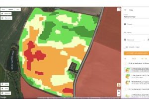
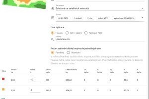
We implement satellite imaging for precision agriculture within vegetation indices such as EVI, NDVI, NDWI, LAI, FAPAR, NDMI, based on which application maps can be created for variable fertilizer application and seeding.
Satellite monitoring allows monitoring of crop development, easy identification of problem areas in the field, comparison of crop performance in individual fields or evaluation of the impact of agronomic work.
Variable applications are an efficient way to distribute inputs to plots to balance crop performance, increase yields by up to 18% or reduce fertilizer costs by up to 20% depending on the strategy chosen.
Soil sampling is a good basis for creating application maps for stock fertilization (pH, phosphorus, potassium, magnesium and calcium). It is carried out on a 3 ha grid and 20 - 30 injections are made per mixed sample.


